


UAS 400-acre Survey & Mapping
August 13th, 2021


We often talk about implementing technology in innovative ways to address engineering challenges within our communities, and we have learned that incorporating Unmanned Aerial Systems (UAS) services into our inspection and surveying methods can be incredibly valuable and effective for quickly gathering data in hard-to-reach areas.
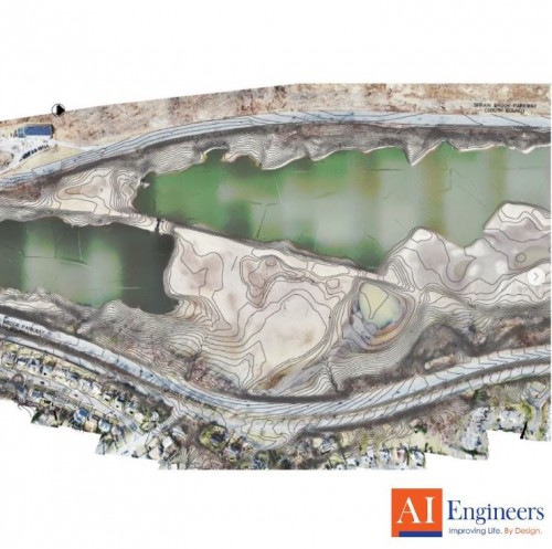
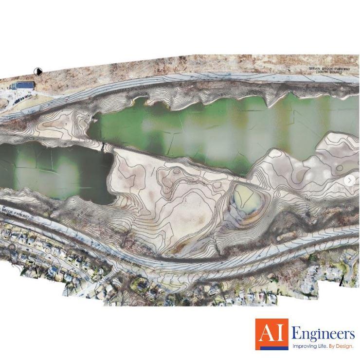
One of AIE’s FAA Part 107 Remote Pilots along with our team of engineers recently flew a UAS over the 400-acre Grassy Sprain Reservoir in Yonkers, NY. Flying for over 100 minutes, we captured upwards of 1,000 20-megapixel, geotagged, high-resolution nadir images of the site. The data was processed through photogrammetry software and produced orthomosaics, contours, and point clouds, allowing the client to visualize every aspect of the reservoir from their office.
Posted in the category AIE Insights.