


UAS RI School Site Survey & Mapping
May 12th, 2022


Boundary and topographic surveys for large areas can be time consuming. However, implementing technology in innovative ways can drastically reduce time in the field in specific applications. AIE has found incorporating Unmanned Aerial Systems (UAS) services into our inspection and surveying methods to be incredibly valuable and effective for quickly gathering data in open areas.
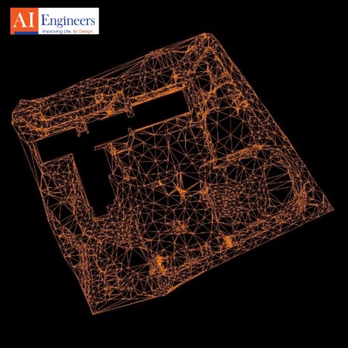
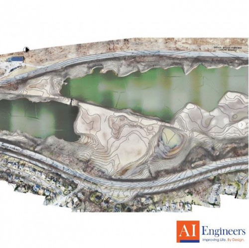
One of AIE’s FAA Part 107 Remote Pilots along with our team of surveyors flew two 20-minute autonomous patterns over a 7-acre property for the Cumberland Rhode Island School Department and collected 20-megapixel geotagged high-resolution nadir photos of the site and ground control points. The data was processed through photogrammetry software and produced orthomosaics, contours, and point clouds, allowing the client to visualize most of the school site from the comfort of their office.
Posted in the category AIE Insights.